Having traveled over a million miles in this country, I have noticed that many communities have adopted some kind of theme or mascot for branding or advertisements. A small group of these have gone all out, creating team-building experiences for businesses, community esprit de corps, art in public spaces and tourist traps (I say that affectionately). It might be cows or bears or even big boots. As you walk around Pensacola, Florida you notice the abundance of pelicans. Pelicans on signs, pelicans flying overhead, and pelican statuary.
The brown pelican (Pelecanus occidentalis) is a year round visitor in Florida. It is warm enough during the winter that they can fish and after nesting season is over, the birds may fly up to North Carolina (they fly as far north as Nova Scotia, but only rarely). Pelicans then return with the New Yorkers for the winter. They are at once peculiar and graceful in flight, adopting a posture of head resting on shoulders. They stay in large groups of both sexes throughout the year and tend to fly in groups. They may adopt a v-formation, but are usually in a line.
It is a real treat to watch brown pelicans fish. Flying over the ocean looking for prey, these birds pull their wings back and dive headfirst into the water, knocking fish unconscious with the shock wave generated when they hit the water. They scoop the fish up in their pouch, return to the surface, dump water out of their pouch, swallow their prey and fly off again. They have to watch the darned kleptoparasites - gulls, skuas, and frigatebirds have been known to swipe food from pelicans. Pelicans can become conditioned to approaching humans for a food handout at seaside restaurants and fishing piers.
The GrandPelican - "Press"ton
2 N. Palafox
One of the most successful public art project is CowParade. A contest to place a design on a fiberglass cow (standing, reclining, or grazing) is held and the winning designs produced and displayed throughout the host cities. The first CowParade took place in Chicago in 1999. Over 75 cities, about 5000 cow and 250 million viewers later, CowParade is still going strong. After the event, cows are auctioned off as fundraisers. The 2002 Portland event was seen by Pensacola News Journal president and publisher Denise Ivey, who thought that something similar would go over well in Pensacola. Since Florida is not really associated tightly with cows, they came up with something unique - Pelicans in Paradise. A Pelican Parade.
Twenty-one pelicans made up the original "flight" from 23 June - 3 July 2004. The second flight of 15 launched November 15-19 and another flight of five were installed in 2005. Many more have been added in the years since, totaling about 70 in all. These fiberglass statues stand about five feet tall, weigh about 70 pounds and stand on bases that are about 450 pounds. Most of these statues are concentrated into downtown Pensacola, although there are many in far-flung locations around the area. Finding all of the pelicans has become a kind of scavenger hunt, and several people have created maps with photos of the various pelicans. If you find a new one, you can add it to the maps along with your pictures.
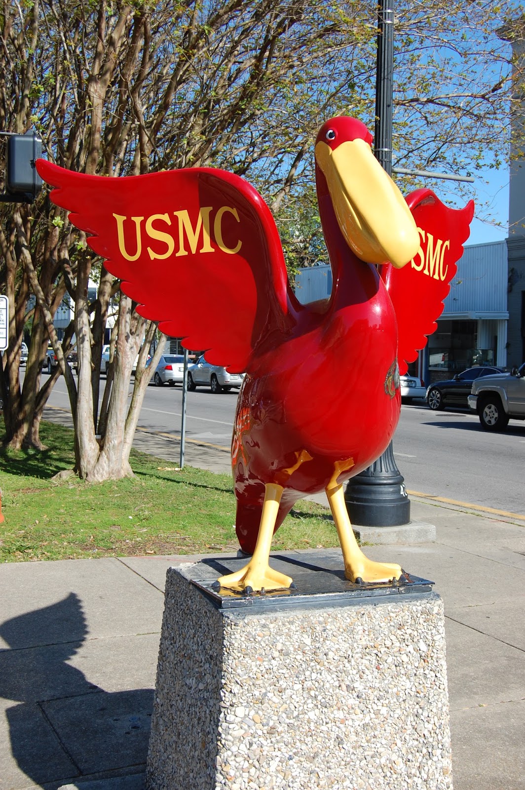
Semper Fi - The Marine Pelican
N. Palafox and E. Garden
The first group that I saw were those honoring the US Armed Forces at the intersection of North Palafox and East Garden Streets. It would take some doing to find and see all of the Pelicans on Parade. Some have been vandalized, damaged or moved through the years. Recently, the concrete base of many of these statues have been replace with pier pilings, giving them a much more nautical look. If you visit downtown Pensacola - see how many you can catch!
Getting There
Downtown Pensacola is most easily approached from the east (Tallahassee) or west (Mobile) from I-10. The Downtown Pensacola exit (I-110 South) will take you into downtown onto Garden Street.
Waypoint: Latitude: 30.413097 N; Longitude: 87.215351 W
Street Address: N. Palafox Street and E. Garden Street
Traveling along US-36/I-72 in Pike County, Illinois (about 20 miles east of Hannibal, Missouri) you encounter highway signs that proclaim that this is "Free Frank McWorter Historic Memorial Highway" and there are signs to "Free Frank McWorter Gravesite". Being the smart-aleck that I am, I have often wondered why? Who or what is free? Is it the highway? Is it Frank? Or is the attraction free? Through time, other signs were added for "Free Frank McWorter gravesite New Philadelphia" and "New Philadelphia founder Free Frank McWorter gravesite, National Register of Historic Places". If it's good enough for the National Register of Historic Places, it should prove to be somewhat interesting. Nadienne and I were looking for something to eat, so it was a good place to get off the road.
Town plat in incorporation documents
At first glance, old New Philadelphia is nothing to look at; just an open field. There are some old buildings on the site. They are not original to New Philadelphia, but were built in the same era. A recent owner of the land moved them here for preservation. If you look hard, you can make out the town plan - looks like a bunch of squares. The two buildings above sit on lots 7 and 8 of block 3, just about the corner of King and Ann Streets. It was founded, it grew as the US population migrated north and west, then shrank as the US population moved into bigger cities. The town was not impressive in just about any way, except in who founded the town, to what purpose the town was founded and the groups of people that lived here. All of the stuff that you can't read in the land.
New Philadelphia
Town plan in 1872
The townsite itself was plotted as 144 lots, each measuring 60 ft x 120 feet. Each block contained 8 lots. The gravels streets were planned so that the major streets (Broad and Main) were 80 ft wide, the secondary streets were 60 ft wide and alleys were 15 ft wide. The town occupied a total of 42 acres.
New Philadelphia was founded in 1836 by a former slave, Free Frank McWorter. Although colonies of freed blacks had been established before, this town was different. It is the first town platted and legally registered by an African-American prior to the Civil War. Free Frank used the proceeds from sales of lots to buy the freedom of his children and grandchildren who were still enslaved at that time. New Philadelphia is also one of the first wholly integrated towns in the United States, where whites, blacks, and biracial people lived willingly side by side on equal footing. The only facilities that appear to be segregated are the cemeteries, as even school facilities were integrated (although some accounts maintain that there was a school for whites and a school for blacks until 1874). There is no clear picture as to why that might be, but I think that the cemetery for blacks started as the McWorter family cemetery and expanded to include extended family and friends.
New Philadelphia population trends 1850-1880
Each lot in town for sale to individuals was sold, and many sold multiple times. It was an attractive investment at the time, with land speculators first betting on the Illinois-Michigan canal passing the town site and later, that railroads would build stations there. A store was established in New Philadelphia in 1839 and a post office existed by 1850, along with a blacksmith shop, wheelwright, two shoemakers and two cabinet makers. Total population climbed steadily from 58 residents in 1850 to a peak census population of 171 in 1865. It is interesting that this town founded by a black man always had a majority white population. The black population held steady until a postwar influx of freed southern slaves in 1865, but the population across all categories declined from that point forwards.
Racial balance in New Philadelphia 1850-1880
The decline of New Philadelphia was brought about by a complex variety of factors. One of the largest may be the routing of the Hannibal and Naples to the north of New Philadelphia. During this time frame, rural areas were depopulating because of movement of people to larger cities and to the newly opened western states. In 1885, the eastern blocks (1, 10, 11, 20) and the eastern half of the adjoining blocks (2, 9, 12, 19) were declared vacant and returned to agricultural use. This eradicated Maiden Lane and Canton Street. Queen Street was renamed Stone Street. These changes shrank New Philadelphia down to 27.5 acres. By the early 20th century, about 6 households were left in town, mostly involved in farming. By the 1940s the townsite was almost totally abandoned.
Modern aerial map with town grid overlay
Free Frank McWorter
Bust of Free Frank McWorter based on descriptions
and pictures of descendants.
Outside of being a fully integrated antebellum town founded by a former slave, the story of New Philadelphia itself is as unremarkable as the story of its founder is amazing. Free Frank McWorter was born a slave in 1777 South Carolina's Piedmont region (Union County) near the Pacolet River. His mother was an African woman named Juda and his father was most likely her owner, George McWhorter. He was of mixed race and is described in various documents of the time as "yellow" or "mulatto". Being a slave, he was known at this time simply as Frank.
He was moved to Pulaski County, Kentucky in 1795. It is quite possible that my 6x great-grandfather Nicholas Jasper knew McWhorter and Frank, since the Jaspers lived in Union County, South Carolina in the 1770's before moving to (and naming) Pulaski County, Kentucky. In 1820 and 1830, several Jaspers are found on Census pages adjoining Free Frank, so they lived nearby. Free Frank married a slave woman named Lucy from the neighboring farm of a distant McWhorter family connection, William Denham. At this time, marriages between slaves carried no legal standing, since a slave was the property of their owner. Frank fathered four children while enslaved: Judy, Sally, Frank and Solomon. By 1810, Frank was allowed to hire himself out for work, and was allowed to keep any monetary amount beyond that charged by McWhorter for his slave's work. Frank also set up a saltpeter mining operation, providing a key ingredient for gunpowder manufacture.
Lucy McWorter c. 1870 painting by George Neal
from family daguerreotype
When George McWhorter died in 1815, he made no provision for the manumission (freeing from slavery) of Frank, so Frank was transferred with the rest of the estate property to McWhorter's heirs. By 1817, Frank had saved enough money to purchase the freedom of his wife from her owner at the price of $800 (about $14,500 in 2016 money). Already recognized as a sharp businessman, Frank demonstrates his shrewdness here, since Lucy was pregnant. Their son,Squire, was born a free person, and that is one less purchase Frank would have to make. Frank paid for his own freedom for the same amount from the McWhorter's. His manumission papers were signed on 13 September 1819. Two more children were born in freedom: Commodore and Lucy Ann.
Frank continued to live in Pulaski County, Kentucky mining saltpeter, speculating on land and farming. By the time of the 1820 Census, Frank had adopted the name Free Frank, announcing his status as a free man. In 1829, Free Frank traded his saltpeter operation for Frank Jr.'s freedom. By this time, Frank Jr. had escaped to Canada, and this business deal allowed him to return to the United States a free person. In 1830, Free Frank is listed as Free Frank Denham in Pulaski County, Kentucky with two sons, two daughters, Lucy and himself listed as free colored persons.
Interpretive sign in information kiosk at roughly the corner of Broad
and North Streets
Remaining free could be a tricky proposition for a black person in antebellum USA. Kidnappers could seize a free person, burn their papers and sell them back into slavery. Free Frank wished to gain some breathing room by moving to a free state. He was able to buy a quarter section of land (160 acres) on the Military Tract of Illinois from Dr. Galen Elliott. In 1830, Free Frank and his free family moved north, wintering in Greene County, Illinois. During the trip, Frank Jr. lagged behind his parents, decreasing the chance that kidnappers could capture all of them. All told, the family would fetch about $4000 on the slave market (about $105,250 in 2016 money). They arrived on their land in Hadley Township, Pike County, Illinois in spring of 1831. An early history of the county noted that "the first white man to settle Hadley Township was a black man".
This was a turbulent time in Illinois politics. Bordering slaveholding states on the south and west, political maneuvering was taking place to variously make Illinois a slave state, a free state, a slave state that barred free blacks and finally an all-white state barring all blacks. Free Frank's land ownership circumvented a requirement by Illinois at the time for free blacks to post a $1000 ($26,000 2016 dollars) bond before emigrating to Illinois.
Free Frank set to rapidly improving his land, and had 80 acres in production within two years, using tools that he brought with him from Kentucky. He farmed oats, barley, flax, potatoes, cattle, hogs and horses. Lucy helped in the operation by raising poultry, making butter, cheese, and collecting honey. The farm was successful enough that Free Frank could buy another 80 acres directly south of his farm and buy his son Solomon from slavery by 1835. This additional 80 acres was used to lay out the town of New Philadelphia in 1836. In all, Free Frank owned 600 acres of Illinois land. When Free Frank incorporated the town, it was noted that he intended to used the profits from the sales of town lots to purchase the freedom of his family that remained enslaved.
1872 property map of Hadley Township around New Philadelphia
Illinois law did not very clearly spell out the rights of freed blacks to own land. In addressing this, 14 white citizens of Pike County vouched for Free Frank's character. He then petitioned the Illinois legislature for a legal last name (McWorter), allowing his children to take his name, and spelled out his rights as a citizen, having "the right to sue and be sued, plead and be impleaded, purchase and convey both real and personal property in said last mentioned name". This created precedent for all free blacks to own property. By the time that Free Frank McWorter died in 1854, he had purchased the freedom of his children remaining in slavery, as well as his daughter-in-law Louisa and two grandchildren. His will directed his heirs to purchase the freedom of the rest of the family, which occurred prior to the start of the Civil War. In all, he purchased the freedom of 16 individuals at a cost of about $14000 (2016 equivalent, about $370,000).
It is an amazing story. A man born a slave, establishing a business, buying freedom for his family and himself. The arc of success continued throughout Free Frank's life, he started a town, that fostered a tolerant society, secured property rights for blacks in Illinois and left his family in position to carry on his legacy. Many of the McWorter's remained as farmers after the demise of New Philadelphia in 1885, but most have scattered across the country, still building up a stronger, better nation. Their story can be seen in part on an episode of Time Team America (Season 1, Episode 3).
Getting There
Much work is still being done in terms of archaeological study of the site. When we visited, there was a covered kiosk for the interpretive signs. It appears from pictures that individual house sites are being marked as they are uncovered.
From US-36/I-72, exit at Barry, Illinois (exit 20). Take County Highway 4 south to Illinois Highway 106. Turn east on IL-106. Turn northeast onto County Highway 2 east to New Philadelphia townsite at 360th Ln.
Waypoint: Latitude 39.698023 N; Longitude 90.961322 W
Beds rich in fossils are very rare. In a very few places, conditions preserve the fossils in such detail that things such as pigmentation, three dimensional structure and cellular structure can be seen. These areas are called Lagerstätten or Konservat-Lagerstätten. And they always seem to be way out in the middle of nowhere. Is that really necessary? As you can tell by the picture to the left, the Cleveland-Lloyd Dinosaur Quarry in Utah is no exception. It contains the densest concentration of Jurassic dinosaur fossils found anywhere in the world.
It is also noteworthy in the
Bones situated where they were found in 3D-space
abundance of carnivorous dinosaurs. About 2/3 of the dinosaur fossils found are of theropods, mostly the apex predator Allosaurus fragilis. Sauropods, the big long-necked dinosaurs like Brachiosaurus, Camarasaurus, and Barosaurus, are found to a lesser extent. Ornithischians like Stegosaurus are also represented in the bone bed. To date, over 12,000 bones have been collected and accessed into museum collections. The Utah Museum of Natural History, University of Utah, Brigham Young University and Princeton University are major excavators of this bonebed, which is now a National Natural Landmark administered by the Bureau of Land Management.
Students excavating on site
Two buildings now cover the part of the bonebed with the densest concentration of dinosaur bone. This protects the site from sunlight, weather, bone poachers and vandals. It also makes excavation conditions right tolerable in the summertime. Excavations are still taking place and bones are uncovered, removed for study and then some are returned for display in the place and orientation in which they were discovered. When we were there, two college students were working on excavations and acting as interpreters of the bone barn. Walkways allow the visitors to look over the bonebed without actually touching the surface.
When you study fossils from a
Walkway and bonebed
particular location long enough, you start to be able to identify where they are from by their coloration. The Cleveland-Lloyd Dinosaur Quarry fossils are recognizable by their beautiful black color. This is due to the unique blends of minerals found at the location during the time that the bone bed was formed. This fossil bed is in the Upper Jurassic Morrison Formation (156-147 million years old). Specifically, this bed is in the Brushy Basin Member, which is mostly mudstone made from volcanic ash. Braided rivers flowed from the west into a basin, forming Lake T'oo'dichi' (Gesundheit). This lake would have been salty and alkaline, much like modern Great Salt Lake.
Allosaurus fragilis maxillary, vertebrae and chevrons
Exactly why this fossil bed is here and why it contains the mix of organisms that it does. It is very rare for a fossil assemblage to contain more carnivores than it does herbivores. One idea is that as seasonal droughts set in, ground water would turn the volcanic ash into mud, trapping dinosaurs that came in for a drink. Packs of young carnivores may have found the temptation to scavenge an easy meal great, especially as the smell of rotting meat increased. The predators would then become mired in the mud and eventually die of starvation. A competing hypothesis is that this low spot would be one of the last surviving watering holes and that the carnivores came here to hunt herbivores. After the supply of herbivore meat was exhausted, the carnivores turned on each other and those left eventually died around here as the result of drought conditions.
Why do we have to be out in the sticks/BFE?
Mostly theropod bones
To have a really good fossil location you first have to have access to exposed rocks of the proper age. The more extreme the climate, the more that physical forces such as cycles of freeze/thawing and erosion can break down sediment and expose fossils. The fossil hunter also has to be at the location at the time that the fossil is exposed and collect the fossil. The ideal area is not impacted greatly by human activities than can destroy the fossils. Fossil sites are often exposed by construction, but paleontologists are usually given a very short time frame to come and remove fossils before the construction project resumes. I have seen more than one Pennsylvanian-era fossil forest fall to the bulldozer in Kansas City.
Long time working
It is likely that dinosaur bones were found by farmers as they drove livestock through the area. The first organized excavation of record was conducted by F.F. Hintze and the Geology Department of the University of Utah in 1927. A crew from Princeton University worked the quarry for the 1939-1941 field seasons under W.F. Stokes. The quarry was idle until 1960 and a variety of institutions have conducted field work there since, including the Utah Museum of Natural History, the University of Utah and Brigham Young University.
Allosaurus fragilis arm
The Cleveland-Lloyd Dinosaur Quarry was named a National Natural Landmark in 1965. The Bureau of Land Management established its very first visitor center on the site in 1968. A new visitor center has since been constructed and opened in 2007. This new visitor center is run entirely on electricity gathered using rooftop solar panels. The visitor center houses exhibits detailing the history and geology of the site. An excellent mounted Allosaurus skeleton is exhibited here. If you like dinosaurs and are looking for something a little bit different, this is a nice drive and worth the effort.
Getting There
From I-70, turn north onto UT-10. Turn right (east) onto UT-155 and go into Cleveland, UT. If you feel like you have to take a relief break, Cleveland is your last chance at comfortable facilities for about an hour. In Cleveland, turn right (south) onto S. Center Street/CR-204 (1.5 mi). Turn left (east) onto S. Flat Bus Loop (0.3 mi), then slightly right onto CR-208 (1.4 mi), then continue onto CR-206 (2.1 mi). Turn left (north) onto Vicor Reef Rd (4.0 mi). Turn right onto Dinosaur Quarry Rd/CR-216 (5.1 mi) and then turn slightly left onto the road to the Cleveland-Lloyd Quarry Visitors Center (1 mi). You are there. Good luck getting back; hope you left some breadcrumbs.
Waypoint: Latitude 39.324019 N; Longitude 110.687683 W
If you look around, you are liable to run into all manner of critters. Some of them are especially memorable. While walking around the country, I have often caught a bit of movement out of the corner of my eye. Sometimes they are colorful, others not. Some will sit still, others you'll be lucky to get a camera lens on. On one hike in Colorado, we chased one of the prettiest lizards that I have ever seen down the trail. The Eastern Collared Lizard (Crotaphytus collaris) males are especially colorful.
These guys are pretty big, reaching lengths up to 14 inches. They have a bright yellow head, with a black collar at the neck and blue body. Known as a "mountain boomer" these animals make little in the way of noise, except for the occasional squeak. When they are threatened they scurry away or may stand up on their hind legs and run. I never could quite get a camera focused on one of these guys on a run.
Such big reptiles like to have a warm basking space (100 - 105 degrees F) and warm weather at other times (80 degrees F) for good digestion of their food. They are found from Missouri west into the Rocky Mountains, south into Mexico and around the south tip of the Rockies into California. They are mostly insectivores, but may eat some fruits and vegetables.
Getting There
You can find these guys across most of the southwestern US
On more than one vacation, we have found ourselves on a little gray line with no number out in the middle of nowhere to see one sight or another. Most of these are dirt or gravel roads. Sometimes you find what you are looking for, sometimes not. Sometimes you even end up with a busted tire.
Cottonwood Wash and Buckhorn Wash roads run through the middle of fantastic red sandstone formations of the Jurassic Navajo Sandstone Formation, the Triassic Wingate Sandstone and Permian Coconino Sandstone in an area called the San Rafael Swell. This area is rich in archaeological evidence of Fremont, Paiute and Ute cultures. The Fremont people lived in the area about 2000 years ago, at about the same time as the neighboring Pueblo peoples and may have been an offshoot of the "Anasazi" cultural group. Evidence suggests that the Fremont were a foraging and corn/maize farming culture, with smallish villages with pithouses. Climate change seems to have displaced the culture about 950 A.D. They certainly moved westward and some may have found their way to Nebraska/Kansas as the ancestors of the Dismal River culture.
The Barrier Canyon culture left art throughout modern Emery County, Utah. One of the most impressive is the Buckhorn Wash pictograph panel. You can see the scope of the panel in the picture to the left using Nadienne and short Christian for scale. The pictographs were made on a freshly exposed sandstone canvas. Red pigment composed of ground hematite (iron (III) oxide) was likely mixed with animal fat, egg, or water, and brushed onto the surface of the rock with brushes made from animal fir or plants. The pigment soaked into the porous rock and has stayed visible for about two thousand years. Weather and modern vandals are the primary threats to the continued existence of this art panel.
Some of the figures are obviously human. Many of the figures have holes pecked in their chest. What they originally represented is unknown and why holes have been deliberately picked in their chest is also a mystery. It may be that the figures held some power for the Fremont peoples and the holes released the power of the art, maybe by a rival or later culture. Were the figures ritually killed? All questions with no answers.
An attempt to cover some of the figures with yellow paint was made long ago. Again one asks "Why?" Did the aesthetics of the culture change? Did a later culture try to alter or cover them up?
Look a little closer
We would like to know what it all means, but we'll just have to keep guessing and enjoying.
Uplifted sandstone - see the ripple marks?
Figures with vandalism apparent
Extreme close-up
Bird-Men or Angels?
Chiselers
The area also contains petroglyphs, which are pictures chiseled out of the rock. The sandstone is polished and the iron oxidizes (rusts) over time, leaving a reddish varnish on the rock. By pecking away at this layer, one can create images in the stone. These designs may be of animals, people or symbols. Meanings are largely unknown, but guesses are handy.
The lower part of the image above could be interpreted as a sheep, but what about the square subdivided into four squares? Is it a representation of the four winds? These drawings may have been painted at some point in the past. Are they the embodiment of power that the artist was calling upon? Ritual? Creativity?
A human riding a deer? Turtles? People?
Long Long Ago....
Vacation with the Hoffmans is hard work
Getting There
Take Buckhorn Wash/Draw Road (Rd 332) north from Exit 131 of I-70 in Utah for 22.7 miles.
Waypoint: Latitude 39.123533 N; Longitude 110.693870 W