 |
| World's Largest Baseball |
As you pull into the town of Muscotah, Kansas you are greeted with a sign that proclaims THIS is the birthplace of Joe Tinker of "Tinker to Evers to Chance" fame. Now any good baseball fan knows that there are two great baseball poems worth remembering:
Casey at the Bat and
Baseball's Sad Lexicon. The phrase "Tinker to Evers to Chance" from
Baseball's Sad Lexicon recalls the Baseball Hall of Fame double play combination from the world beating Chicago Orphans/Cubs of the early 20th century: shortstop Joe Tinker to second baseman Johnny Evers to first baseman Frank Chance. Joe Tinker was born in this tiny Kansas community on 27 July 1880 and spent two years here before the family moved to Kansas City, Kansas in 1882.
 |
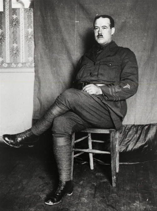
| "Tinker to Evers to Chance" |
How should you memorialize the town's favorite son; a professional baseball and pop culture icon? Did you say with the worlds largest baseball? If you did, then you would be correct. In a little park, just off of US-159 in Muscotah is the world's biggest "baseball". This enormous piece of sporting gear was constructed from a water tower tank, and has stitches made of rebar. To complete the glorious kitsch is a miniature baseball infield complete with cutouts of three baseball players near first and second bases. Yes, I see a little silhouetto of a man. Scaramouche...
Joe Tinker by the numbers
Born: 27 July 1880, Muscotah, Kansas
Died: 27 July 1948, Orlando, Florida
Teams
Chicago Orphans/Cubs 1902-1912 (National League)
Cincinnati Reds 1913 (National League)
Chicago Chi-Feds/Whales 1914-1915 (Federal League - defunct Major League)
Chicago Cubs 1916
Championships
National League - 1906, 1907, 1908, 1910
World Series - 1907, 1908
Federal League - 1915
Career Statistics
Games: 1,084
Batting average: 0.274
Hits: 1690
Doubles: 263
Home runs: 31
Triples: 112
RBI: 782
Stolen bases: 336
Starting salary (2015 value): $40,944
Total 15 year salary (2015 value: $1,511,277)
That Double Play Again/Baseball's Sad Lexicon by Franklin Pierce Adams
 |
| Tinker to Evers to Chance |
These are the saddest of possible words:
“Tinker to Evers to Chance.”
Trio of bear cubs, and fleeter than birds,
Tinker and Evers and Chance.
Ruthlessly pricking our gonfalon bubble,
Making a Giant hit into a double—
Words that are heavy with nothing but trouble:
“Tinker to Evers to Chance.”
 |
| The Honda for size |
Nice words. Right lyrical on the ears. They were written in a pinch by Franklin Pierce Adams for his "Always in Good Humor" column in the New York Evening Mail. It was deadline time and he was running short of copy. Since the editor didn't care a bit for white space, Adams wrote this on his way to see his New York Giants at the Polo Grounds. These three guys were to Adams what Madison Bumgarner, Jose Bautista and John Lester are to Kansas City Royals fans. All on one roster. Shortstop to Second to First - double play.
Year in and year out, Adams' Giants fell to the pennant hogging Cubs (yeah, you read it right). The Cubs won the winner take all season pennant in 1906, 1907, 1908 and 1910, winning the World Series in 1907 and 1908. The 1906 Cubs won 116 games in a 152 game season. This poem was printed first on 12 July 1910 - a year that saw the Cubs beating out the Giants for the pennant.
In 1908, Evers was the player that saw what would be immortalized as "Merkle's Boner". With two out n the bottom of the ninth of a 1-1 game against the Giants, Moose McCormick was on third and Fred Merkle was on first. McCormick appeared to score the winning run on an Al Bridewell single in the bottom of the ninth inning. Seeing fans swarming the field, Merkle went to the dugout without touching second base. Evers called for the ball and the umpire ruled Merkle out by a force out, nullifying the run. The umpire and National League president both called the game a tie because of darkness, forcing a replay, which the Cubs won. This was a source of consternation for the Giants, because it was customary for the defense not to appeal for a force-out on a walkoff hit.
 |
| Left to right: Tinker, Evers, Chance |
Then as now, a bit of good marketing will make all the difference in the world to a product. While Tinker, Evers and Chance were not even the best double play combination of their day, the cadence was catchy and they became household names. All three were elected to the Major League Baseball Hall of Fame, despite their skimpy numbers by today's standard. They had great numbers for the deadball era and showed flashes of great defense. Baseball Reference ranks Tinker at #217 as a hitter all-time, Evers at #224, and Chance #385. The poem didn't hurt. "Tinker to Evers to Chance"? Right up there with "Tippecanoe and Tyler, too!".
Tinker did lead National League shortstops in fielding percentage during four seasons. He had hustle, as well, stealing home twice in a single game on 28 July 1910. In Chance's later years he switched to player-manager and then just manager of the Cubs. He still has the team's highest winning percentage as a manager. Evers would be the 1914 National League MVP and win another World Series title with the Boston Braves.
Me against my brother. Me and my brother against the world.
 |
| The inside of the baseball will eventually be a museum |
While it might seem that these guys would be all buddy-buddy, that was far from reality. Tinker and Evers HATED each other. They had both come to the big leagues during 1902, and their falling out occurred quickly. The legend is that in 1905, while the team was waiting in a hotel lobby prior to an exhibition game in Washington, Indiana, Evers jumped in a cab and rode to the ballpark, leaving everyone else behind. When Tinker made it to the ballpark, he apparently called out Evers and the first of many fistfights ensued. That is likely not the whole story, but two things do seem to be universally agreed upon: people didn't much care for Johnny Evers and Joe Tinker loved to get into fights.
Evers would say it best later in life: "Tinker and myself hated each other, but we loved the Cubs. We wouldn't fight for each other, but we'd come close to killing people for our team. That was one of the answers to the Cubs success."
Adams wasn't the only one to put these guys into rhyme.
Ogden Nash put them in for the letter "E" in his
Line-Up for Yesterday published in Sport Magazine in January 1949:
E is for Evers
His jaw in advance
Never afraid
To Tinker with Chance
Getting There
Muscotah is definitely a town that has seen better times. Built (and rebuilt) to capture traffic from the Central Branch of the Union Pacific Railroad in 1857. The Delaware River provided power for the grist mill. The town still has several old houses and older style churches with intricate woodwork that you just cannot find today. Having worked at a full-service gas station in college, I can't help but notice the old service stations when passing through towns. Muscotah's is a treat, with a sign, brands and prices of gas and oil that were available back when they filled 'er up, checked your fluids and washed your windshield when you bought gas. Sadly, the old pumps have been pulled out.

I have to hand it to the townspeople for building an attraction that will hopefully continue to grow and bring many a baseball fan calling. The museum in the shape of a baseball shows promise. The easiest road to travel here is to travel to Hiawatha, KS on US-36 or US-73 and take US-73/US-159 south. Stay on US-159 south at Horton, KS and you will travel directly into Muscotah. The big baseball is in a park behind (just north of) the old service station at US-159 and Kansas Street.
Waypoint: 39.551195 N; 95.521636 W
Further Reading
Portraits of "Tinker, Evers and Chance"


